49 SHAWMUT RD
Owner Information
49 SHAWMUT STREET RLTY. TRUST;
49 SHAWMUT ROAD
WALTHAM, MA 02452-8043


Property Details
49 SHAWMUT RD is classified as a Single Family Residential (Raised ranch).
The primary structure on this property was built in 1960. There are 2,300ft2 of built area within this property. There is 2,300ft2 of residential/living space within this property. This property is listed as having 7 rooms.
49 SHAWMUT RD is valued at $660,300. The land is valued at $371,000 and the structures are valued at $289,300.
The most recent deed for 49 SHAWMUT RD is recorded at the local registrar in Book 79111, Page 582. 49 SHAWMUT RD was last sold on Wednesday, November 10, 2021 for $100.
Assessment data from fiscal year 2022.
Flood Data
According to the FEMA National Flood Hazard Layer, this property does not appear to be in a flood zone. It may also be in an area not yet reviewed. Nonetheless, confirm this information prior to taking any action.
To view the flood hazards around this property, create a FEMA "Firmette" Map of the area around 49 SHAWMUT RD.
Broadband Internet Providers
| Provider | Type | Bandwidth (mbps) | |
|---|---|---|---|
| Crown Castle Fiber | Fiber | 0 | 0 |
| Verizon New England Inc. | Fiber | 940 | 880 |
| Comcast | Cable | 1000 | 35 |
| RCN | Cable | 1000 | 20 |
| RCN | Cable | 500 | 20 |
| VSAT Systems, LLC. | Satellite | 2 | 1 |
| HughesNet | Satellite | 25 | 3 |
| GCI Communication Corp. | Satellite | 0 | 0 |
| Verizon New England Inc. | DSL | 5 | 0 |
| Viasat Inc | Satellite | 100 | 3 |
Broadband service provider data from December 2020.
Adjacent Properties
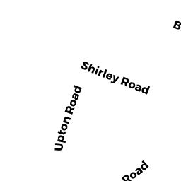
- 72 SHIRLEY RD
Single Family Residential owned by BARRY, GEORGE W. & KAREN E. - 84 SHIRLEY RD
Single Family Residential owned by KILLEWALD, PHILLIP & ALEXANDRA - 43 SHAWMUT RD
Single Family Residential owned by MOSCHNER, LINDA J. - 36 FREEMONT TERR
Single Family Residential owned by BARYAKHTAR, IGOR & VALERIYA - 78 SHIRLEY RD
Single Family Residential owned by DAVIS, CALEB A. & ALBERTO N. - 54 SHAWMUT RD
Single Family Residential owned by FORD, PATRICK & CHADINE